A state places border signs and checkpoints along its boundary.
Diagnosis: Territoriality because the state is marking and controlling space.
Unit 4 Learning Journey · Step 8
Territoriality in AP Human Geography is the attempt by people, groups, or states to claim, control, defend, or organize space.
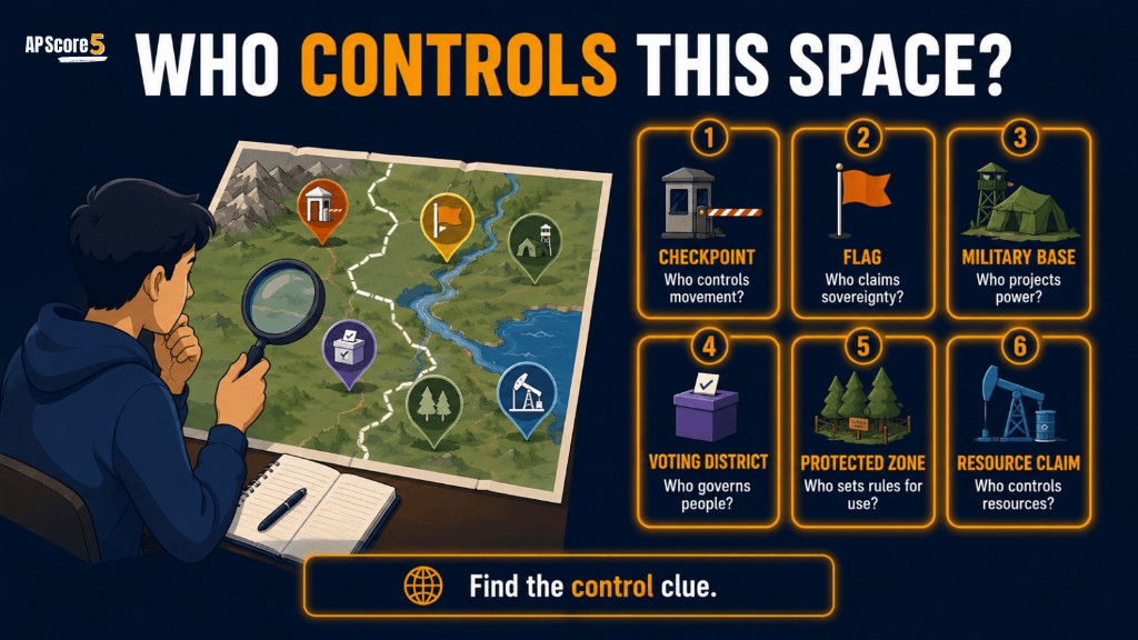
Territoriality is why borders, checkpoints, flags, fences, maps, military zones, districts, and symbolic places matter. States use territoriality to show where their authority applies, while groups use territoriality to express identity or control. This guide explains how to spot territoriality in AP maps, examples, MCQs, and FRQs.
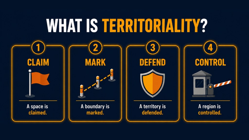
Territoriality is the attempt by people, groups, or states to claim, control, defend, or organize a space. In AP Human Geography, territoriality helps explain why states create boundaries, defend borders, regulate movement, mark national symbols, control resources, and organize political space.
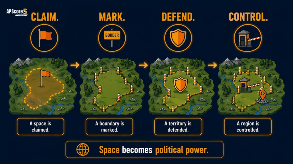
Territoriality means:
The earlier pages taught what states are, how sovereignty works, how political boundaries organize territory, and why boundary disputes happen. Territoriality is the next step because it explains how states and groups actively claim, mark, defend, and control space.
Meaning: States or groups disagree over boundary wording, location, operation, or resources.
Meaning: States and groups claim, mark, defend, and control space.
You are on Step 8 of the Unit 4 sequence.
Meaning: Some narrow places become strategically important because they control movement.
Territory and territoriality are related, but they are not the same.
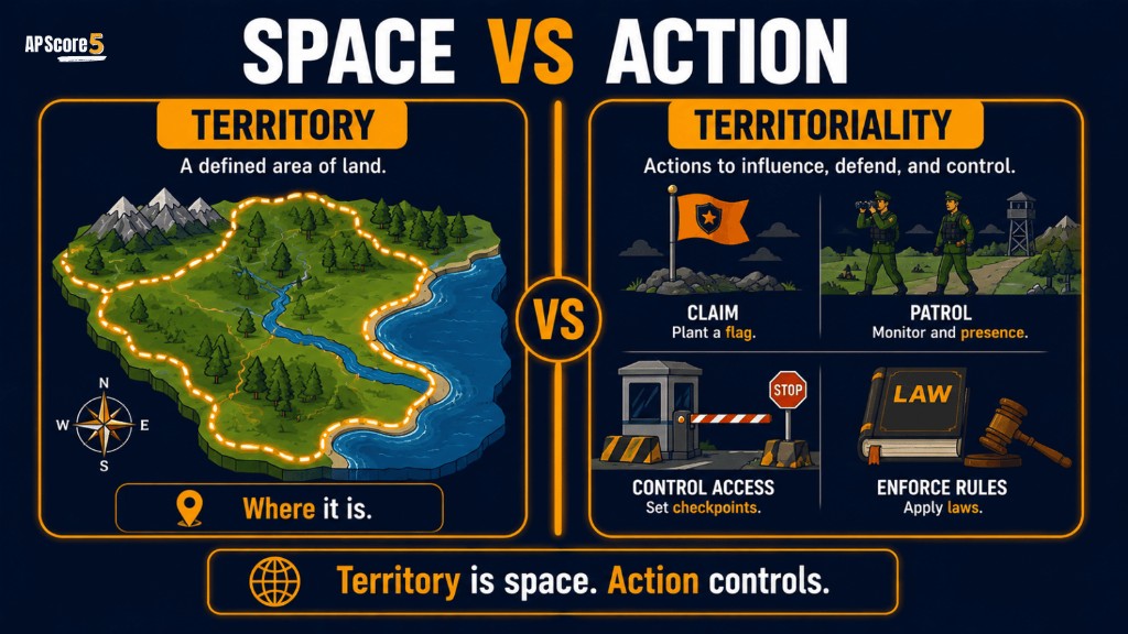
| Term | Simple Meaning | AP Clue | Example |
|---|---|---|---|
| Territory | The actual area of land or water controlled or claimed | “What space is controlled?” | A state’s land area |
| Territoriality | The behavior or strategy used to claim, mark, defend, or control that space | “How is space controlled?” | Borders, flags, checkpoints, patrols |
Use this framework throughout Unit 4: every territoriality example usually involves one or more of these actions.
A state or group says a space belongs to it.
The space is marked with boundaries, maps, flags, signs, monuments, checkpoints, or symbols.
The space is protected through laws, patrols, military presence, barriers, or political action.
The space is managed through rules about movement, resources, taxes, laws, voting, land use, or identity.
| Action | What It Means | AP Example Clue |
|---|---|---|
| Claim | Assert authority over space | “This territory belongs to us” |
| Mark | Show control visibly | Flags, border signs, walls, maps |
| Defend | Protect the space | Patrols, military zones, border security |
| Control | Manage what happens inside | Laws, checkpoints, resource rules |
States use territoriality to make sovereignty visible and practical. A state cannot just claim power in theory; it must organize that power across space.
States use boundaries to show where political authority begins and ends.
States use checkpoints, patrols, visas, and customs rules to control movement.
States use flags, monuments, capitals, maps, and ceremonies to reinforce identity.
States use territorial claims to manage land, water, oil, minerals, fishing zones, and strategic routes.
States divide territory into provinces, states, districts, counties, or regions to govern more effectively.
States protect key spaces such as ports, capitals, borders, choke points, and military bases.
Review political boundaries for how lines organize authority, and boundary disputes for when control over those lines breaks down.
Sovereignty means a state has authority over its territory. Territoriality is one way that authority becomes visible. States show sovereignty by marking borders, enforcing laws, defending territory, managing resources, and controlling movement.
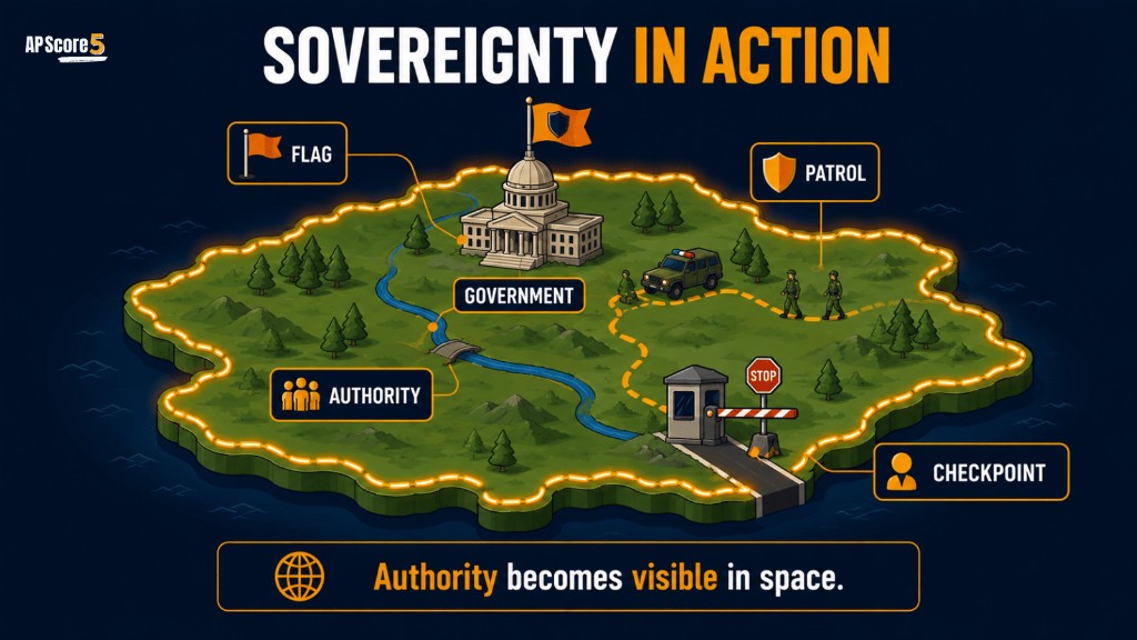
Legal authority over territory.
Actions that claim, mark, defend, or control territory.
Go deeper on legal authority in the sovereignty guide—this page focuses on what states and groups do in space.
Boundaries are one of the clearest tools of territoriality. A boundary marks where control changes from one political unit to another. But territoriality can also appear inside boundaries through districts, capitals, border zones, military zones, checkpoints, or symbolic landscapes.
See the full boundary-type list on Types of Boundaries and the foundation on Political Boundaries.
Territoriality is not only about state power. Groups also use space to express identity, belonging, memory, and control. Flags, monuments, neighborhoods, sacred sites, language signs, ethnic enclaves, and nationalist claims can all show territoriality.
In AP Human Geography, focus on the connection between space, identity, and control—not simple “good” or “bad” labels. Nation–state mismatches often surface here; see the nation-state mismatch guide for how identity and territory diverge.
Show territoriality by controlling who and what enters a state.
Show territoriality by marking space with national identity.
Show territoriality by defending important spaces.
Show territoriality by concentrating state authority and symbolic power.
Show territoriality when states try to control strategic movement corridors.
Show territoriality when states claim ocean space, fishing rights, oil fields, or exclusive economic zones.
Show internal territoriality because political power is organized through mapped districts.
Show territoriality when groups seek more control over a region they identify with.
Examples can overlap with sovereignty, boundaries, disputes, nationalism, or devolution. For AP questions, identify what action is being taken to control or mark space.
Read each scenario and decide how territoriality appears. Tap Reveal control action when you are ready.
A state places border signs and checkpoints along its boundary.
Diagnosis: Territoriality because the state is marking and controlling space.
A government builds a national monument in its capital city.
Diagnosis: Territoriality because the state is symbolically marking national space.
A state patrols a maritime zone to protect fishing rights.
Diagnosis: Territoriality because the state is defending and controlling ocean space.
A regional group demands greater control over its historic homeland.
Diagnosis: Territoriality because the group is connecting identity to control of space.
A country creates voting districts to organize elections.
Diagnosis: Territoriality because political power is organized through mapped space.
A government places military bases near a strategic strait.
Diagnosis: Territoriality because the state is defending a key space and movement route.
A border checkpoint regulates migration and trade.
Diagnosis: Territoriality because the state controls movement across territory.
Flags are displayed on government buildings in a disputed region.
Diagnosis: Territoriality because symbols are being used to claim or mark space.
A protected border zone limits who can enter for security reasons.
Diagnosis: Territoriality because access to space is being controlled.
A map labels an island chain as part of a state's national territory.
Diagnosis: Territoriality because the map asserts a territorial claim.
| Mistake | Better AP Understanding |
|---|---|
| “Territoriality just means land” | Territoriality is behavior used to claim, mark, defend, or control space |
| “Territory and territoriality are the same” | Territory is the space; territoriality is the strategy or behavior |
| “Only states use territoriality” | States, nations, regions, groups, and communities can show territoriality |
| “Territoriality only happens at borders” | It can happen inside states through districts, capitals, symbols, or zones |
| “Territoriality is always conflict” | Territoriality can create order, identity, security, cooperation, or conflict |
| “Territoriality and sovereignty are identical” | Sovereignty is legal authority; territoriality is how space is claimed or controlled |
Choices shuffle on each load. Tap an answer for instant feedback.
Which statement best defines territoriality in AP Human Geography?
Which example best shows state territoriality?
What is the difference between territory and territoriality?
How does territoriality connect to sovereignty?
A state displays flags, builds monuments, and maps a disputed region as part of its territory. Which concept is most directly shown?
Which of the following is NOT usually an example of territoriality?
A regional group argues that it should control its historic homeland. Which idea is most relevant?
Open each card, draft your response, then reveal the rubric and sample when ready. In territoriality FRQs, use action verbs: claim, mark, defend, control, regulate, patrol, map, symbolize, or organize.
Tip: Use action verbs: claim, mark, defend, control, regulate, patrol, map, symbolize, or organize.
A. Territoriality is the attempt to claim, mark, defend, or control space.
B. A state can show territoriality at a boundary through checkpoints, patrols, visas, customs rules, or border signs that regulate movement.
C. Territoriality supports sovereignty by making legal authority visible and enforceable through borders, laws, patrols, and resource control.
D. Territoriality can intensify conflict when groups compete over the same space, access, symbols, or resources.
Status: Draft your answer first—then open the rubric or sample.
Tip: Use action verbs: claim, mark, defend, control, regulate, patrol, map, symbolize, or organize.
A. Territory is the area of land or water controlled or claimed by a state or group.
B. Territory is the space itself; territoriality is the behavior used to claim, mark, defend, or control that space.
C. A symbolic example is a national monument or flag that marks space with state identity.
D. A practical example is a border checkpoint that regulates who and what enters territory.
Status: Draft your answer first—then open the rubric or sample.
In territoriality FRQs, use action verbs: claim, mark, defend, control, regulate, patrol, map, symbolize, or organize.
Territoriality is the attempt by people, groups, or states to claim, mark, defend, or control space.
A border checkpoint is an example of territoriality because it shows a state controlling movement into and out of its territory.
Sovereignty is a state's legal authority over territory, while territoriality is how that authority is claimed, marked, defended, or enforced in space.
Territory is the actual space controlled or claimed. Territoriality is the behavior or strategy used to claim, mark, defend, or control that space.
States show territoriality through boundaries, checkpoints, flags, maps, patrols, military bases, monuments, capitals, voting districts, and resource controls.
Yes. Nations, regional groups, ethnic groups, communities, and organizations can show territoriality when they claim, mark, defend, or organize space.
Territoriality is important because it helps explain how political power, identity, sovereignty, boundaries, conflict, and resource control are organized across space.
No. Territoriality can create conflict, but it can also create order, identity, security, governance, and cooperation.
Look for actions that claim, mark, defend, control, regulate, patrol, map, symbolize, or organize space.
Sovereignty is a state's legal authority over territory, while territoriality is the way people, groups, or states claim, mark, defend, or control space.
You now understand how states and groups claim, mark, defend, and control space. Continue the Unit 4 journey with Choke Points, or test yourself with Unit 4 practice questions.
You finished Step 8 of the Unit 4 sequence. Use the path below to move backward for review or forward to choke points and the rest of the unit.