Physical geography
Mountains, rivers, valleys, coastlines, and soil conditions can shape where people build homes and farms.
AP Exam Clue: If houses follow a valley or river, physical geography may explain the pattern.
Unit 5 Learning Journey · Agriculture and Rural Land Use
Rural settlement patterns describe how homes, farms, roads, villages, and fields are arranged across the rural landscape. In AP Human Geography, students use settlement patterns to explain agricultural land use, transportation access, physical geography, historical land division, and rural community organization.
The previous page, Agribusiness, explained how modern agriculture connects farms to businesses, processing, transportation, retail, and consumers. This page shifts from food systems to rural landscapes. Rural settlement patterns show how people arrange homes, farms, roads, and villages across agricultural land. After this page, students should study land survey patterns, sustainable agriculture, and Unit 5 practice questions.
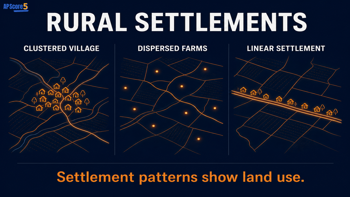
The rural settlement patterns AP Human Geography topic connects commercial agriculture to rural landscape organization. When a prompt shows a village cluster, scattered farmsteads, or houses along a road or river, identify the pattern and explain why it formed.
Rural Settlement Patterns
Layout reveals how rural communities use land.
Rural settlement patterns are the ways homes, farms, roads, and villages are arranged in rural areas. In AP Human Geography, the three major patterns are clustered settlements, dispersed settlements, and linear settlements. These patterns can reveal agricultural practices, transportation routes, land survey systems, physical geography, history, and social organization.
AP prompts often show one layout on a map. Your job is to name the pattern and explain what it suggests about rural land use. Compare patterns with the intensive vs extensive agriculture guide when farm size and household location matter.
| Pattern | What It Looks Like | Why It Happens | AP Exam Clue |
|---|---|---|---|
| Clustered | Homes grouped close together | Shared services, defense, water, community, or common fields | Village cluster or nucleated settlement |
| Dispersed | Farms and homes spread apart | Individual farms, large fields, private land ownership | Isolated farmsteads across open land |
| Linear | Homes arranged along a line | Road, river, coast, canal, valley, or transportation route | Houses follow a physical or transport feature |
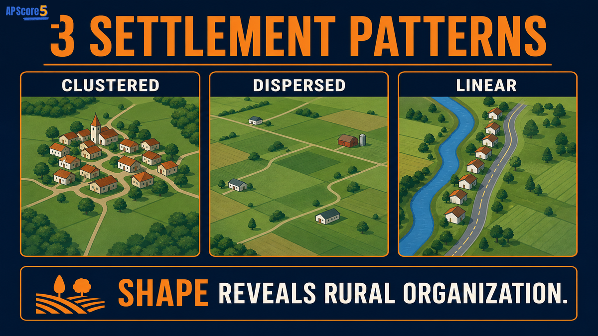
Settlement patterns explain why some rural areas show a dense village surrounded by fields, why others show isolated farmsteads across open land, and why some communities stretch in a narrow line along a transport route or physical feature.
A rural settlement pattern is not just a farm type. It describes the spatial arrangement of homes, fields, roads, and villages across the rural landscape. See subsistence vs commercial agriculture for production goals—not layout.
| Farm Type | Settlement Pattern | AP Exam Meaning |
|---|---|---|
| Describes what is produced | Describes how rural features are arranged | Do not confuse production with layout |
| Examples include dairy, grain, ranching | Examples include clustered, dispersed, linear | One is economic; one is spatial |
| Focuses on agricultural activity | Focuses on geographic pattern | Use map evidence to explain settlement |
| May change with markets | May reflect history, land survey, terrain, or roads | Explain cause, not just appearance |
Rural settlement patterns do not appear randomly. Physical geography, access to water, transport routes, land ownership, survey systems, farming practices, history, and community needs all shape where people build and how farms are organized.
Mountains, rivers, valleys, coastlines, and soil conditions can shape where people build homes and farms.
Springs, rivers, wells, and reliable water supply attract homes and villages to specific locations.
Roads, canals, railroads, and trade paths organize where people settle and how goods move.
Private farms, communal fields, and inheritance patterns affect whether homes cluster or spread out.
How land is legally divided can encourage grid farms, long narrow parcels, or irregular holdings.
Pastoralism, grain farming, and mixed farming influence where households locate relative to fields.
Colonial patterns, migration, and earlier village sites leave lasting rural layouts.
Grouping homes for safety, shared services, or common fields can create clustered villages.
These factors overlap with Von Thünen model thinking when market access and transport costs influence where farming households locate relative to cities and routes.
Use this table when an AP question asks you to compare patterns or explain map evidence for each layout type.
| Feature | Clustered Settlement | Dispersed Settlement | Linear Settlement |
|---|---|---|---|
| Basic shape | Homes grouped together | Homes spread apart | Homes follow a line |
| Common clue | Village cluster | Isolated farmsteads | Road, river, canal, coast |
| Why it forms | Shared services, community, defense, common fields | Large private farms, individual farm households | Transportation or physical feature |
| AP map clue | Dense rural node | Scattered dots | Long narrow line of homes |
| Common mistake | Calling every village urban | Forgetting the farming link | Forgetting the feature being followed |
Rural settlement patterns often connect to land survey patterns because land division affects how farms, roads, and homes are arranged. For example, rectangular land division can encourage dispersed farms, while long narrow parcels can support linear settlement along rivers or roads.
Study the full comparison in land survey patterns. On FRQs, pair visible settlement layout with property-line evidence when both appear on the map.
A village with houses grouped around a church and shared fields shows a clustered settlement.
Farmhouses spread across large private farms show a dispersed settlement.
Houses lined along a river show a linear settlement.
Homes following a road through farmland show a linear settlement.
A rural area shaped by rectangular property lines may support dispersed farms.
A settlement in a valley may follow physical geography.
Use this four-step method on MCQs and FRQs when a prompt describes village clusters, scattered farmsteads, or homes along a line.
Name clustered, dispersed, or linear from map evidence.
Point to grouped homes, scattered farms, or houses along a line.
Water, roads, land ownership, farming practices, physical geography, or history.
Explain how the pattern reflects agricultural organization or community needs.
The rural settlement pattern is __________ because __________. This pattern likely formed due to __________, which shaped how homes, farms, and roads were arranged.
Example: The rural settlement pattern is linear because homes are arranged along a river. This pattern likely formed due to water access and transportation, which shaped how homes, farms, and roads were arranged.
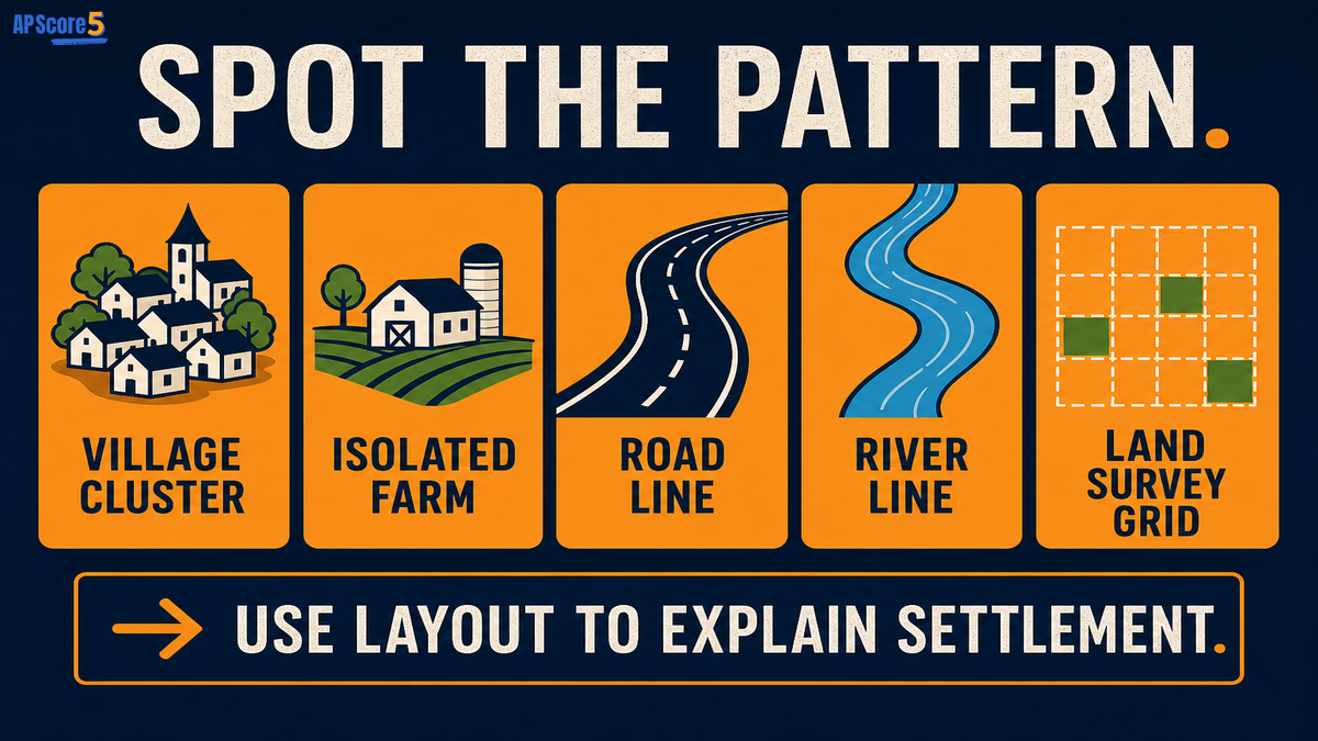
One Perfect AP Sentence: A rural settlement pattern shows how homes, farms, roads, and villages are arranged, and the pattern can reflect physical geography, transportation routes, land ownership, agricultural practices, or historical settlement.
Use this sentence when an FRQ asks you to explain how rural landscapes reveal land use.
| Concept | Main Meaning | AP Clue |
|---|---|---|
| Farm type | What is produced or how farming works | Dairy, grain, ranching, plantation |
| Settlement pattern | How rural features are arranged | Clustered, dispersed, linear |
| Land survey pattern | How land parcels are legally divided | Grids, long narrow parcels, irregular boundaries |
Calling every rural cluster a city
Describing the pattern but not explaining why it formed
Confusing farm type with settlement pattern
Forgetting roads and rivers can create linear patterns
Ignoring land ownership or survey systems
Saying dispersed means "no agriculture"
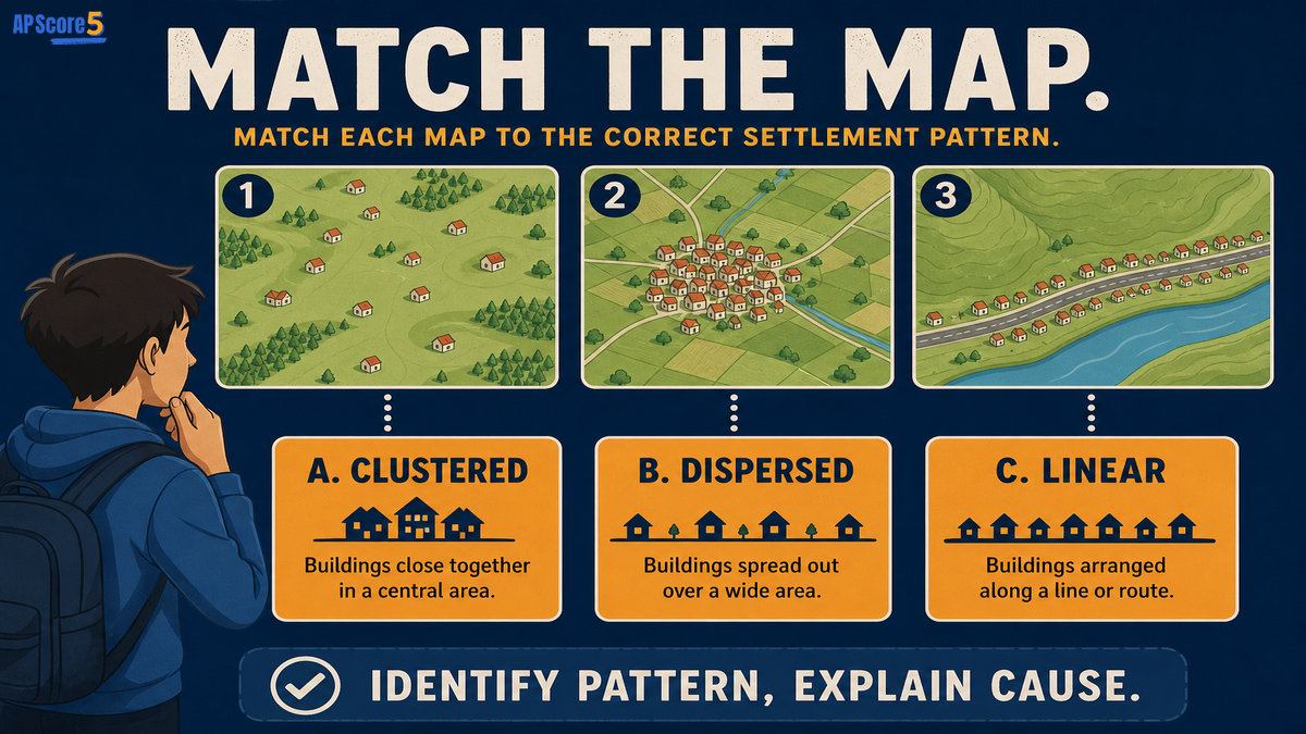
Read each scenario, predict the settlement pattern, then reveal the answer. This trains the same reasoning AP Human Geography uses on rural land use map prompts.
Revealed: 0 of 4 scenarios
A rural map shows homes tightly grouped around a village center with farmland outside the village. Which settlement pattern is shown?
Answer: Clustered settlement, because homes are grouped close together around a central rural node.
A map shows individual farmhouses spread far apart across large fields. Which settlement pattern is shown?
Answer: Dispersed settlement, because homes and farms are scattered across the rural landscape.
A settlement follows a river in a long narrow line. Which settlement pattern is shown?
Answer: Linear settlement, because homes follow a physical feature that provides water or transportation.
A road cuts through farmland, and most homes are built along the road. Which settlement pattern is shown?
Answer: Linear settlement, because the road organizes the arrangement of homes.
Answer all eight questions. Choices shuffle each time you reload, so focus on reasoning—not letter memorization.
Open each card, draft your response, then reveal the rubric and sample when ready. Strong settlement FRQs identify the pattern, cite map evidence, explain why it formed, and connect the layout to rural land use.
A rural landscape shows homes grouped close together in a village with agricultural fields surrounding the settlement. Identify the settlement pattern and explain one reason this pattern may have formed.
The settlement pattern is clustered because the homes are grouped close together in a village. This pattern may have formed because residents shared services, water access, community institutions, or common agricultural fields. The surrounding farmland shows that the village is connected to rural land use, with people living close together while farming nearby land.
Status: Draft your answer first—then open the rubric or sample.
A map shows homes arranged in a long line along a river. Explain how physical geography or transportation could have shaped this settlement pattern.
The map shows a linear settlement because homes are arranged in a line along the river. The river may provide water, transportation, fertile land, or a route through the landscape. Because rural households often locate near useful physical features, the settlement follows the river rather than spreading evenly across the area.
Status: Draft your answer first—then open the rubric or sample.
Rural settlement patterns are the ways homes, farms, roads, and villages are arranged across rural landscapes.
The three main rural settlement patterns are clustered settlement, dispersed settlement, and linear settlement.
A clustered rural settlement has homes and buildings grouped close together, often around a village center, church, market, water source, or shared agricultural land.
A dispersed rural settlement has homes and farms spread out across the landscape, often because each household lives near its own fields.
A linear rural settlement has homes arranged in a line, often along a road, river, canal, coast, or valley.
Rural settlement patterns form because of physical geography, water access, transportation routes, land ownership, land survey systems, agricultural practices, historical settlement, and community needs.
Rural settlement patterns describe where homes and farms are located, while land survey patterns describe how land parcels are legally divided.
Identify the pattern, cite map evidence, and explain why the pattern formed using factors such as roads, rivers, land ownership, physical geography, or agricultural practices.